Space communication products and services
Ground system solutions that you can rely on
From communication ground systems to software-defined solutions and satellite communications, Calian solutions are critical components in missions ranging from Earth observation and telecommunications to deep space exploration.

Innovative ground systems for projects that can't fail
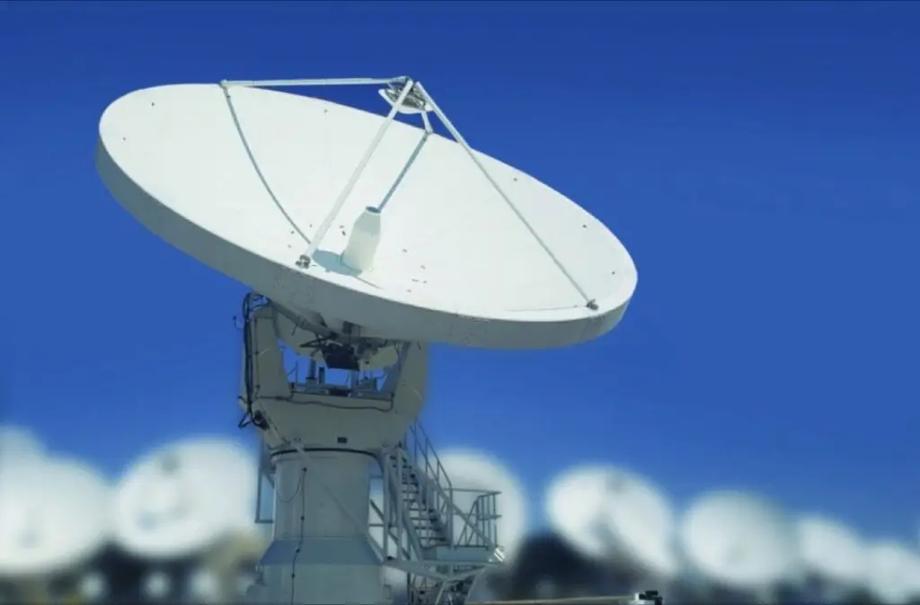
Antennas
Calian has a complete line of antenna products with metal or composite carbon fibre panels suitable for a variety of applications including satellite communications, deep space and radio astronomy, and defence.
We also manufacture custom antennas and will work with you to create the antenna that suits your project requirements, from initial design through to long-term maintenance and support after installation.

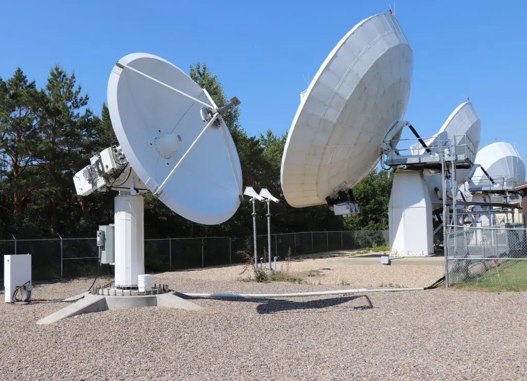
RF Systems
Calian builds state-of-the-art RF systems tailored for satellite communication, deep space missions and radio astronomy. Our portfolio spans from L-band to V-band antenna and RF systems, covering satcom, TT&C and deep space solutions.
Our scope starts with requirements definition and extends to long-term maintenance and support after installation.

RF products
Calian manufactures a wide range of RF products for a variety of applications. Our RF products are designed, manufactured and tested in-house and installed internationally.
Communication gateways
Calian has been delivering innovative solutions to satellite operators for more than two decades, enhancing the operational efficiency of their worldwide communications networks. From monitor and control systems that boost uptime, to resource management systems that increase capacity, to gateway systems that enable communications, Calian offers the essential tools for optimizing your ground segment.
Software -defined solutions
For more than 20 years, Calian has been providing satellite operators with innovative solutions to improve the operating efficiency of their global communications networks. Whether it be monitor and control systems to improve uptime, resource management systems to improve capacity, or gateway systems to provide communications, Calian has the solutions you need for your ground segment.


Satellite capacity management system
Calian’s next-generation satellite capacity management system (SCMS) delivers the latest advances in satellite communication payload and link propagation analysis techniques and modelling.
The SCMS is an advanced software system used by satellite operators and satellite service providers for planning and managing the use of their satellite capacity.


Custom resource management systems
We build systems for planning and managing satellite communications networks. Our solutions are used to manage, monitor, and optimize valuable satellite payload resources and spectrum to maximize the coverage and capacity of your satellite networks. Our solutions scale from a single satellite to a constellation of satellites providing global coverage.
Calian’s resource management systems are ideal for managing today’s flexible and high-throughput satellite communication payloads.
Tools for today’s satellites
Calian has a suite of planning tools and applications designed to help operators manage their satellite networks. These include applications for long-term capacity planning, sizing service based on customer requirements and beam coverage analysis.
These tools are used to manage capacity sizing, capacity planning and antenna coverage.
Satellite capacity management system
Calian’s next-generation satellite capacity management system (SCMS) delivers the latest advances in satellite communication payload and link propagation analysis techniques and modelling.
The SCMS is an advanced software system used by satellite operators and satellite service providers for planning and managing the use of their satellite capacity.
Custom resource management systems
We build systems for planning and managing satellite communications networks. Our solutions are used to manage, monitor, and optimize valuable satellite payload resources and spectrum to maximize the coverage and capacity of your satellite networks. Our solutions scale from a single satellite to a constellation of satellites providing global coverage.
Calian’s resource management systems are ideal for managing today’s flexible and high-throughput satellite communication payloads.
Tools for today’s satellites
Calian has a suite of planning tools and applications designed to help operators manage their satellite networks. These include applications for long-term capacity planning, sizing service based on customer requirements and beam coverage analysis.
These tools are used to manage capacity sizing, capacity planning and antenna coverage.

Satellite operations services

Teleport services
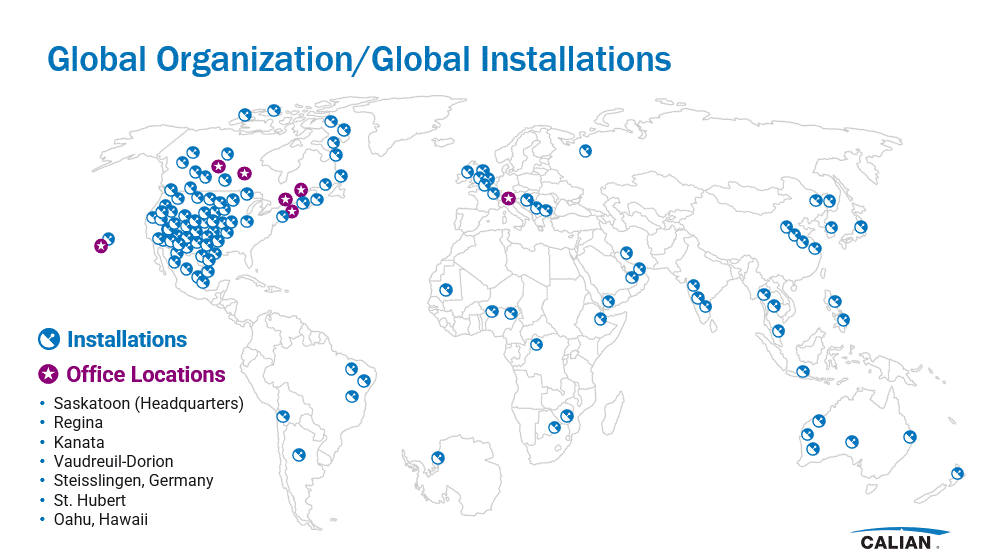
Teleports are located in Hawaii, Guam and Saskatoon, providing satellite communication services around the world. Additionally, Calian has access to third-party sites across the Canadian Arctic to host customer equipment.
Satcom products
Calian is an established full-service satellite communications technology development company, and we’ve supplied the satellite industry with sophisticated ground systems, services and products for decades. We help the satcom industry communicate and stay connected by providing innovative products and solutions that deliver high performance and reliability in a world that’s always changing.
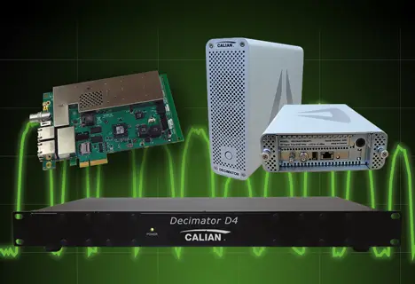
Decimator RF spectrum analyzer
Our Decimator spectrum analyzer remotely monitors RF signals anywhere in the world with a standard web browser and internet connection.
- The Decimator is ideal for the measurement of RF communications and broadcast carriers in satellite, wired and terrestrial wireless networks.
- The Decimator is available in three form factors, including multiport (4/8 port), PCIe card and portable.
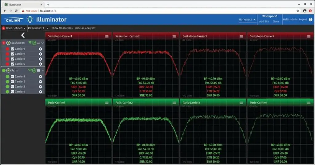
Illuminator
The Illuminator software add-on is ideal for users with multiple Decimators. It’s a multi-site carrier monitoring solution with centralized monitoring and control of your entire set of carriers.
Illuminator provides dashboard visual features to view your current results from multiple remote sites, and it allows you to navigate your long-term results for a particular carrier at any remote site.
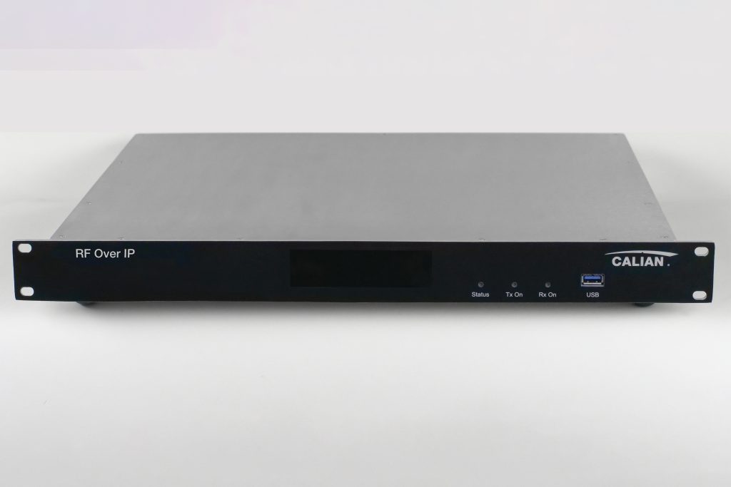
Transporter digitizer
The Calian Transporter Digitizer is your solution for seamless conversion of analog signals into digital packets for global satellite signal streaming. Signals can be easily transferred across any IP network, allowing for efficient and seamless communication.
With its cutting-edge FPGA processing and wide signal frequency range from 450 MHz to 4.0 GHz, the Transporter is perfect for digitizing multiple satellite carriers from any type of satellite.

In-orbit test systems
Test satellite payloads efficiently and with high accuracy. Calian’s in-orbit test (IOT) systems provide the full suite of tools you need to effectively test satellite payloads immediately after launch and during routine operation of the satellite.
Calian’s IOT systems offer:
- Fully automated measurement sequences
- Automated calibration routines
- Fast, accurate proprietary test algorithms
- Graphical operator interface for configuration and monitoring
- Easy-to-generate measurement reports in PDF format
- Reliable architecture using commercial off-the-shelf hardware

Talk to a Calian expert today
Reach out to learn how our innovative solutions can help you solve your most complex challenges.